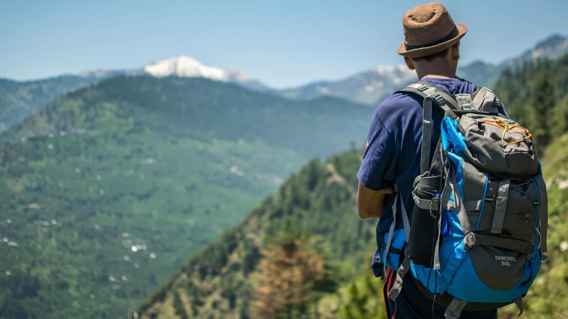
The Meesapulimala trek is one of the most rewarding high-altitude experiences near Munnar, taking travelers through shola forests, rolling grasslands, mist-covered ridges, and some of the most dramatic landscapes in the Western Ghats. It is also a distinctive addition to a wider itinerary covering the best places to visit in Munnar.
Rising approximately 2,640 metres (8,660 feet) above sea level, Meesapulimala is one of the highest peaks in the Western Ghats and a well-known trekking destination near Munnar in Kerala’s Idukki district. The landscape here is characterised by rolling grasslands, pockets of shola forest, rhododendrons, misty ridges, and expansive mountain views.
Unlike a typical Munnar sightseeing stop, visiting Meesapulimala requires planning, physical effort, and an authorised trekking arrangement. If you are considering adding the trek to your Munnar itinerary, here is what you should know before you go.
Meesapulimala is located in the Idukki district of Kerala, around 20 km from Munnar, in the high ranges of the Western Ghats. The peak lies within the mountainous landscape surrounding Munnar, between the Anaimalai Hills and the Palani Hills.
The authorised trekking route is managed through the Kerala Forest Development Corporation (KFDC). The approach to the trekking area generally begins from the Munnar side, with visitors proceeding towards the designated Base Camp.
From there, the route continues by jeep towards Rhodo Valley, the last motorable point on the official route, before the trek towards Meesapulimala begins on foot.
Travelers should confirm the current reporting point, timings, and access arrangements with KFDC before their visit, as trekking operations can change depending on weather and local conditions.
A trip to Meesapulimala is different from driving directly to a regular sightseeing attraction.
Visitors generally travel from Munnar to the designated KFDC reporting point or Base Camp according to their booking arrangements. From there, the authorised route includes a jeep-accessible section leading towards Rhodo Valley.
Rhodo Valley is the final motorable point on the official route. The remaining journey towards Meesapulimala is completed on foot with the authorised trekking arrangement.
Starting early is also advisable, as Meesapulimala is best treated as a full-day outdoor experience rather than one stop among several tightly scheduled attractions.
Altitude alone is not what makes Meesapulimala memorable. The real attraction is the landscape you encounter along the way.
The trek passes through a combination of shola forests and montane grasslands, two defining ecosystems of the higher Western Ghats. As the trail gains elevation, the surroundings gradually open into broad slopes, ridges, valleys, and mountain views.
One of the most distinctive areas along the route is Rhodo Valley. As its name suggests, the area is associated with rhododendrons, including the Nilgiri rhododendron found in the Western Ghats.
Mist is another constant feature of the high ranges. A clear ridge can disappear behind clouds within minutes before opening again to reveal layers of distant mountains. This rapidly changing scenery gives the trek a very different character from Munnar’s roadside viewpoints.
The wider landscape is also wildlife habitat. Nilgiri tahr, gaur, and elephants are among the animals associated with this region, although wildlife sightings are never guaranteed.
Visitors should always maintain a safe distance from animals and follow the instructions of their guide.
The Meesapulimala trek is best approached as a full-day outdoor experience rather than another stop on a packed sightseeing schedule.
The trekking portion covers approximately 8 km in total, including the onward and return journey. The walk can take several hours depending on the weather, trail conditions, and individual pace. The terrain includes uneven mountain paths, climbs and descents, grassland sections, and stretches where mist or rain can make walking more difficult.
Technical climbing skills are generally not required on the documented trekking route, but a reasonable level of fitness and stamina will make the experience considerably more comfortable.
If you regularly walk, hike, exercise, or climb stairs, you should be better prepared for the trek. Travelers who lead a mostly sedentary lifestyle may benefit from adding regular walking or basic cardio exercise in the weeks before their trip.
Most importantly, do not rush. Meesapulimala is as much about experiencing the landscape along the trail as it is about reaching the higher ridges.
Yes. Meesapulimala should not be treated as an unrestricted, self-guided trekking destination.
Access is managed through the Kerala Forest Development Corporation (KFDC) ecotourism programme, and visitors are required to use authorised trekking arrangements.
As of August 2026, the booking charge for the Meesapulimala trek is ₹2,000 plus applicable taxes. A jeep for the designated jeep-accessible section of the route costs approximately ₹3,800 extra.
Before travelling, confirm the current booking procedure, reporting location, guide arrangements, identification requirements, timings, and package inclusions directly with KFDC.
While these rates are current at the time of writing, prices and access arrangements may change in the future. Mountain conditions can also affect trekking operations.

For most travelers, October to March is a practical period to plan a Meesapulimala trek.
These months generally coincide with Munnar’s more comfortable post-monsoon and winter travel season. Cooler temperatures and comparatively favourable conditions can make several hours of trekking more pleasant.
That does not mean clear skies are guaranteed.
Weather in the high ranges can change quickly. Mist, wind, cloud cover, and occasional rain can appear even when conditions elsewhere in Munnar seem pleasant.
The heavier monsoon months can make trekking more challenging because of rainfall, slippery trails, and reduced visibility. Access may also be affected by local weather conditions.
Whatever month you choose, check the weather forecast and confirm that the trekking programme is operating before travelling to the reporting point.
KFDC operates accommodation programmes connected with the Meesapulimala trekking area, including facilities associated with Base Camp and Rhodo Valley.
An overnight stay can be a useful option for travelers who want to experience the high ranges at a slower pace. Instead of combining a long road journey and demanding trek into a single rushed day, you can arrive earlier, rest, and prepare for the following day’s walk.
However, accommodation availability, rates, inclusions, and trekking packages can change.
A heavy backpack can quickly become uncomfortable on a long mountain trail, so carry only what you are likely to need.
Useful essentials include:
Check what food, drinking water, or other essentials are included in your trekking programme before packing additional supplies.
Avoid disposable plastics wherever possible and make sure everything you carry into the mountains comes back with you.
Meesapulimala’s relatively wild landscape is one of the main reasons the trek feels special, and protecting that environment is part of visiting responsibly.
Stay with your trekking group and guide, particularly when visibility is poor. Avoid wandering onto unofficial trails or taking shortcuts across sensitive vegetation.
Do not litter, pick plants, disturb wildlife, or leave food waste behind. Keep noise levels low and avoid feeding animals.
Reusable water bottles and minimal disposable packaging can also help reduce waste along the route.
Rhododendrons and other native vegetation should be appreciated where they grow rather than picked as souvenirs.
Responsible trekking is simple: leave the landscape as you find it and follow the instructions of the people managing the trail.
If Meesapulimala forms part of a wider Munnar holiday rather than a standalone trekking trip, Chinnakanal can be a peaceful base for exploring this side of the region.
Located away from the busier centre of Munnar town, Chinnakanal is surrounded by plantations, valleys, waterfalls, reservoirs, and mountain scenery. Nearby areas such as Suryanelli and Anayirangal can also be incorporated into a broader itinerary.
The Siena Village, located in Chinnakanal approximately 20 km from Munnar town, offers a comfortable place to return to after exploring the high ranges.
Guests planning the Meesapulimala trek should remember that staying in Chinnakanal does not replace the official KFDC reporting point. Confirm your reporting location and expected travel time beforehand so that you can leave early enough on the morning of the trek.
It is also worth keeping the rest of your trekking day relatively free. After several hours in the mountains, returning to Chinnakanal for a relaxed evening can be far more enjoyable than rushing towards another attraction.
Meesapulimala rises to approximately 2,640 metres, or 8,660 feet, above sea level. Published figures vary slightly between sources, so the elevation is best treated as approximate.
Meesapulimala is sometimes described in tourism material as the second-highest peak in the Western Ghats after Anamudi. However, peak rankings and published elevation data vary between sources.
It is therefore more accurate to describe Meesapulimala as one of the highest peaks in the Western Ghats.
Yes. Trekking access is managed through KFDC’s ecotourism programme. Visitors should confirm the current booking, guide, reporting point, and access requirements before travelling.
The trek can be considered moderate to challenging, depending on your fitness, weather, and trail conditions.
Expect several hours of walking over uneven mountain terrain with repeated climbs and descents. A reasonable level of physical fitness will make the experience more comfortable.
October to March is generally a practical period for trekking because it coincides with Munnar’s cooler post-monsoon and winter season.
However, mountain weather and access conditions can change quickly, so current local guidance should always take priority.
People without extensive trekking experience may be able to complete the authorised route if they have reasonable fitness and are comfortable walking for several hours over uneven terrain.
Preparing with regular walking or cardio exercise before the trip can help. Travelers should also follow their guide’s instructions and avoid pushing beyond their physical limits.
Meesapulimala reveals a side of Munnar that cannot be experienced from a car window or roadside viewpoint.
The journey through shola forests, open grasslands, rhododendron country, misty valleys, and exposed mountain ridges gradually takes you away from the familiar landscapes of the hill station and into the higher reaches of the Western Ghats.
The views from the higher ridges may be the goal, but the journey itself is what makes the experience memorable.
Plan ahead, use authorised trekking arrangements, prepare for changing weather, respect the landscape, and give Meesapulimala the better part of a day. For travelers willing to put in the effort, it can become one of the most rewarding experiences of a Munnar holiday.
Beyond Meesapulimala, Munnar offers tea estates, waterfalls, viewpoints, wildlife areas, and several other experiences worth adding to your itinerary.
Follow Us On


Drop your Queries
Adventure and Outdoor Activities
Attractions / Destination Guides
Culture and Cuisine
Travel Tips and Advice
Resort Facilities
Wellness and Ayurveda
Seasonal Highlights
Recent Post